China just quietly shifted its strategy around Taiwan, and it has almost nothing to do with fighter jets or beach invasion rehearsals.
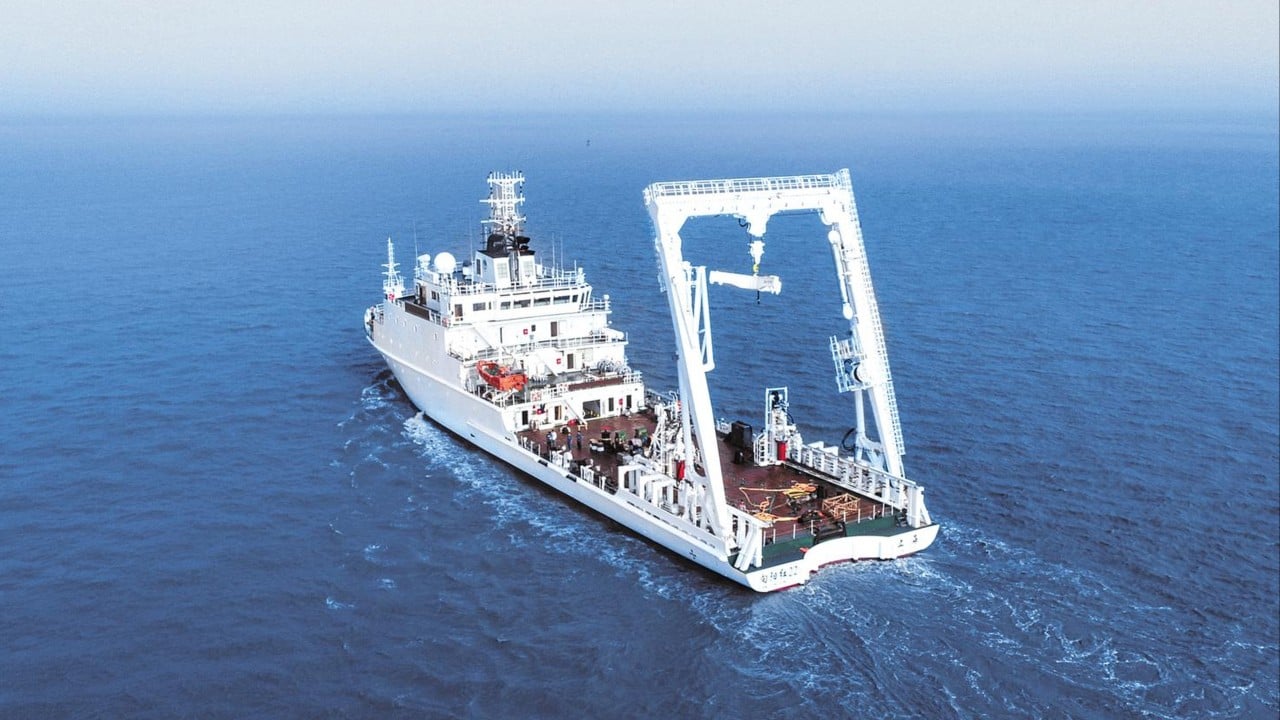
In June and July 2026, Beijing deployed a fleet of non-naval vessels to the deep waters off Taiwan's eastern coast. The deployment included the Xiangyanghong 22 research ship, transport ministry vessels, and a newly formed China Coast Guard patrol group. On paper, Beijing claims these ships were merely conducting a routine, long-term marine environment survey to study seawater DNA, weather, and local wildlife. State media spun it as a simple extension of nearshore governance. You might also find this similar coverage insightful: Why China New Ethnic Unity Law Should Terrify Activists Everywhere.
That is a smoke screen. The sudden focus on a maritime survey east of Taiwan is actually the groundwork for future submarine warfare and a tight maritime blockade.
Most observers spend their time staring at the Taiwan Strait. That is a mistake. The strait is shallow, muddy, and terrible for submarine operations. The real underwater battlefield sits on the other side of the island. To the east, the continental shelf drops off into the abyss of the Philippine Sea and the Ryukyu Trench. It is a vast environment where nuclear submarines can hide, hunt, and cut off Taiwan from the rest of the world. By sending survey ships to map this ocean floor, China is building the precise acoustic and topographic maps needed to control the deep Pacific. As extensively documented in recent coverage by NPR, the implications are worth noting.
The Sudden Shift to Dark Grey Zone Operations
For the past few years, Beijing relied heavily on massive, loud military exercises. They fired missiles, sailed carrier strike groups, and buzzed Taiwan's air defense identification zone with dozens of jets at a time. It was loud theater.
Now, the strategy has turned quiet.
Taiwanese defense analysts call this new phase a dark grey-zone operation. Instead of sending the People's Liberation Army Navy to trigger international alarms, Beijing is using civilian ministries and law enforcement. The Ministry of Natural Resources and the Ministry of Transport are doing the heavy lifting. They are normalizing a continuous administrative presence in international waters that Beijing suddenly claims as its own near seas.
This is classic salami-slicing. By replacing grey hulls with white coast guard hulls and scientific research ships, China makes it incredibly difficult for Taiwan or the United States to respond without looking like the aggressors. If you send a destroyer to intercept a marine biology vessel, you lose the propaganda war. If you do nothing, China maps your backyard.
Why Oceanography Dictates Underwater Warfare
Submarine operations rely entirely on data. You cannot see through deep ocean water. You can only listen. Sound waves behave wildly depending on three distinct variables: temperature, salinity, and pressure.
When a survey ship like the Xiangyanghong 22 spends days dropping sensors into the water east of Taiwan, it is not just looking at whale migration paths. It is measuring the thermocline. The thermocline is the layer of water where the temperature drops rapidly. This temperature shift bends sonar waves. If a submarine sits right beneath a sharp thermocline, sonar beams from a surface destroyer will literally bounce off the layer and miss the sub entirely.
Salinity matters just as much. Fresh water and highly saline water change the density of the sea, creating distinct underwater acoustic tunnels. A submarine commander who knows exactly where these tunnels exist can broadcast or hide signatures with terrifying efficiency.
The waters east of Taiwan are an oceanographic maze. You have the powerful, warm Kuroshio Current sweeping upward from the Philippines. You have complex underwater canyons and the crushing depths of the Ryukyu Trench. Without highly detailed, hyper-local data on these currents and temperature shifts, a submarine is basically operating blind. China is fixing that blind spot. They are building a proprietary database of the Pacific seabed, ensuring their Type 094A and newer attack submarines can exploit every thermal layer available.
The Japan and Philippines Connection
Beijing did not launch this regular survey program in a vacuum. The immediate trigger was a sudden geopolitical shift further south.
In May, Japan and the Philippines held bilateral talks to outline their overlapping exclusive economic zones and continental shelf boundaries east of Taiwan. Tokyo and Manila were attempting to settle their maritime borders cleanly using established international frameworks.
Beijing flipped.
The Chinese foreign ministry lodged fierce protests, slapped sanctions on Philippine Defense Secretary Gilbert Teodoro, and declared the bilateral talks illegal. Why? Because Beijing claims sovereignty over Taiwan, and by extension, it claims the right to dictate any maritime boundary settlements connected to Taiwan's eastern waters.
By sending coast guard patrols and survey ships to the region immediately after those talks, China sent a direct message to Tokyo and Manila. Beijing is stating that no one draws lines in the Western Pacific without Chinese permission. It is using administrative law enforcement to physically overwrite international maritime agreements.
From Scientific Surveys to Total Blockade
The long-term danger of these continuous surveys is how easily they can pivot into a wartime quarantine.
Right now, the China Coast Guard claims it is running routine law-enforcement patrols to safeguard national sovereign rights. They are getting Taiwanese and Japanese mariners used to seeing Chinese official ships east of the island. This creates a dangerous baseline of normalcy.
If Beijing decides to squeeze Taiwan, it will not start with a D-Day style amphibious invasion across the strait. It will likely start with a quarantine. Because the transport and natural resource ministries have spent months mapping the undersea cables, pipe routes, and shipping lanes east of Taiwan, they know exactly where the island's lifeline lies.
A permanent presence of law enforcement vessels can scale up to a full maritime blockade over the course of a single afternoon. They can stop commercial container ships, divert energy tankers, and cut undersea internet cables under the guise of maritime safety regulations. The deep waters that once offered Taiwan a safe eastern rear guard are fast becoming its most exposed flank.
The Next Steps for Regional Navies
The data collection cannot be undone. Once Beijing maps a trench or charts a thermocline, that tactical advantage is locked in. Countering this trend requires aggressive, immediate changes from Taiwan and its allies.
First, Taiwan must expand its own acoustic monitoring networks along the eastern coast. Deploying uncrewed underwater vehicles and permanent hydrophone arrays along the seabed can help track Chinese vessels whenever they approach the deep trenches.
Second, the United States and Japan need to increase their own anti-submarine warfare patrols in the Philippine Sea. They must disrupt the normalization of Chinese administrative control by running frequent, highly visible trilateral exercises in the exact zones China is trying to monopolize.
The battle for Taiwan will not just be fought in the skies or on the beaches. It is happening right now, completely out of sight, thousands of meters beneath the surface of the Pacific.
WION news report on China's maritime claims offers a detailed breakdown of the geopolitical tensions and boundary disputes that triggered this sudden underwater push.