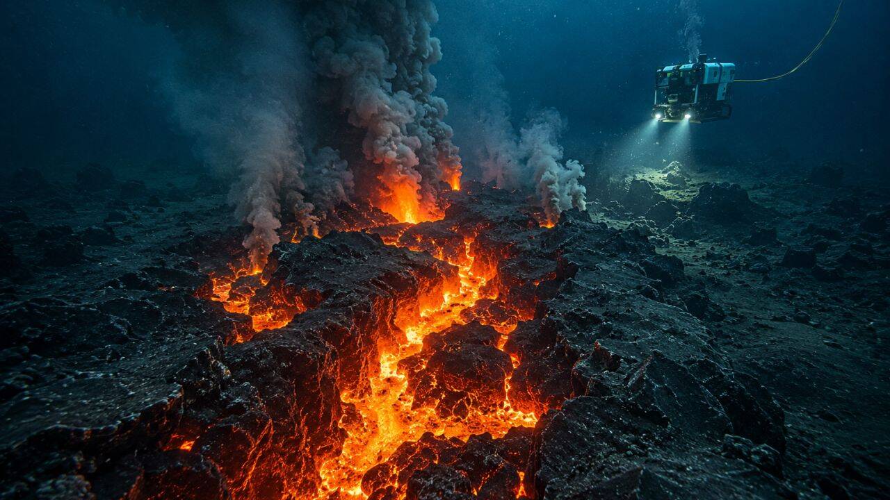
Earth is tearing itself apart at the seams, and we finally caught it in the act.
For decades, textbooks taught us about seafloor spreading as a slow, abstract concept. You see the neat little diagrams of tectonic plates moving apart while red arrows indicate magma rising to fill the gap. It looks peaceful. It looks predictable.
It is completely chaotic.
For the first time, scientists have actually captured a massive seafloor spreading event as it happened, documenting the birth of a brand-new ocean floor. We are not talking about a slow trickle of mud. An astonishing 160 million cubic meters of molten lava burst through the Earth's crust, cooling instantly in the frigid depths of the deep sea.
Most people think the ground beneath our feet is solid and permanent. It isn't. This discovery proves that the surface of our planet is being aggressively, violently remade right now, deep beneath the waves where no human eye can naturally see.
The Lie of a Static Planet
We live on a crust that is constantly recycling itself. The ocean floor acts as a massive conveyor belt. New crust forms at mid-ocean ridges, travels across the globe over millions of years, and eventually dives back into the mantle at subduction zones.
Geologists have known this framework since the mid-twentieth century. But knowing something happens is entirely different from watching it happen.
Historically, studying the deep ocean floor meant looking at ancient history. Scientists would drop sonar equipment down, map a grid, and notice that the topography changed compared to a map made twenty years prior. They were examining the crime scene long after the suspect had fled. They saw the cooled basalt, the hardened pillows of lava, and the cracks in the crust. They missed the main event.
This new observation flips the script. By deploying advanced monitoring networks, researchers detected the exact moment the earth split open. They watched a massive volume of magma inject itself into a rift zone.
Imagine trying to understand how a skyscraper is built by looking only at a completed city skyline. That is what marine geology used to be. Now, we have the blueprint, the construction workers, and the time-lapse footage of the foundation being poured.
Inside the Massive Underwater Eruption
When 160 million cubic meters of lava erupts underwater, it does not look like Hawaii. There are no towering fountains of red fire shooting into the sky.
Instead, the intense pressure of miles of ocean water keeps the volatile gases trapped. The water sits at just a few degrees above freezing. When rock heated to over 1,000°C meets that freezing, high-pressure environment, the physics get weird.
The lava forms what geologists call pillow basalts. The outer layer of the molten rock freezes instantly into a glassy shell. The hot interior keeps pushing through, cracking the shell and creating another bulbous, pillow-like shape. This process repeats over and over, rapidly building up mounds of new crust.
This specific event did not just leak a little bit of material. The volume is hard to comprehend. Think about enough molten rock to fill tens of thousands of Olympic-sized swimming pools, all forced out of a tear in the planetary crust in a flash of geological time.
The sheer force of this eruption physically pushed the existing tectonic plates apart. It literally widened the ocean floor. This is the exact mechanism that separated South America from Africa millions of years ago, played out in miniature right before our instruments.
How Scientists Caught the Seafloor Spreading Red Handed
You cannot just sail a boat over an eruption and look down with binoculars. The deep ocean is pitch black, brutally cold, and carries enough pressure to crush a human like an aluminum can.
To catch this event, researchers relied on an intricate web of underwater technology.
- Hydrophone Arrays: These underwater microphones listen to the low-frequency rumbles of the earth. When magma moves through the crust, it breaks rock, creating a distinct acoustic signature that travels thousands of miles through the water column.
- Autonomous Underwater Vehicles: Free-swimming robotic subs were deployed to glide mere meters above the dynamic zone, using advanced sonar to map the changing topography with centimeter-level precision.
- Seafloor Pressure Sensors: These instruments detect the subtle rising and falling of the ocean floor. As magma builds up underneath the crust, the ground swells. When the eruption occurs, the ground deflates like a popped balloon.
By combining real-time seismic alerts with immediate robotic deployment, the research team bypassed the usual lag time that plagues marine science. They arrived while the water was still chemically altered by the volcanic output.
They found massive plumes of warm, mineral-rich water shooting up into the sea. These hydro-thermal plumes carry high concentrations of iron, manganese, and methane, completely changing the local ocean chemistry and fueling unique ecosystems that thrive without sunlight.
Why One Hundred Sixty Million Cubic Meters of Lava Matters
This is not just a cool fact for science nerds. The volume of this eruption tells us something fundamental about how our planet regulates itself.
The Earth needs to lose heat. The primary way it does this is through the mid-ocean ridge system. If the planet did not vent its internal heat through these massive rifts, the buildup of pressure would lead to catastrophic planetary instability.
By measuring the exact volume of this eruption, scientists can calculate the precise thermal budget of a spreading center. We now know that seafloor spreading does not happen at a steady, creeping pace. It happens in violent, episodic pulses. Long periods of quiet are punctuated by massive bursts of creative destruction.
This specific volume of lava provides a baseline. It allows geologists to build accurate computer models of the planet's interior. We can now better estimate how much carbon dioxide and other gases are vented from the mantle directly into the ocean, which plays a massive role in long-term climate cycles.
The Deep Sea Ecosystems Born from Chaos
Every time the seafloor spreads, it creates life. That sounds counterintuitive when talking about molten rock, but the deep ocean operates on different rules.
In the complete absence of sunlight, photosynthesizing plants cannot exist. Instead, life relies on chemosynthesis. Microscopic organisms break down the toxic chemicals streaming out of the new volcanic vents, turning hydrogen sulfide and methane into energy.
These microbes form the base of a bizarre food web. Giant tube worms, blind shrimp, and predatory crabs flock to these newly formed fields of lava.
When the researchers mapped the new crust, they were also mapping the birth of a new biological colony. Within days of the lava cooling, microbial mats began to coat the fresh rock. The speed at which life claims these toxic, boiling environments is staggering.
By studying these pristine sites, biologists get a front-row seat to the origins of life itself. Many scientists believe that life on Earth did not start in a shallow, sunlit pool, but right here, in the dark, pressurized cracks of a spreading ocean floor.
Actionable Next Steps for Tracking the Changing Earth
You do not need a multi-million dollar research vessel to understand or follow these discoveries. The data coming out of these ocean observatories is more accessible than ever.
- Follow Live Ocean Observatories: Check out public data networks like the Ocean Observatories Initiative. They provide public access to real-time data feeds, hydrophone audio, and live camera streams from active underwater volcanic zones.
- Track Global Seismic Activity: Use tools provided by the US Geological Survey or international monitoring bodies to track earthquake swarms along mid-ocean ridges. When you see hundreds of small quakes clustered along a plate boundary, you are likely looking at magma moving beneath the seafloor.
- Explore Open Source Bathymetry: Use platforms like Google Earth Pro or specialized marine mapping sites to look closely at the global ridge system. Zoom in on the Mid-Atlantic Ridge or the East Pacific Rise to see the physical stretch marks of our planet.