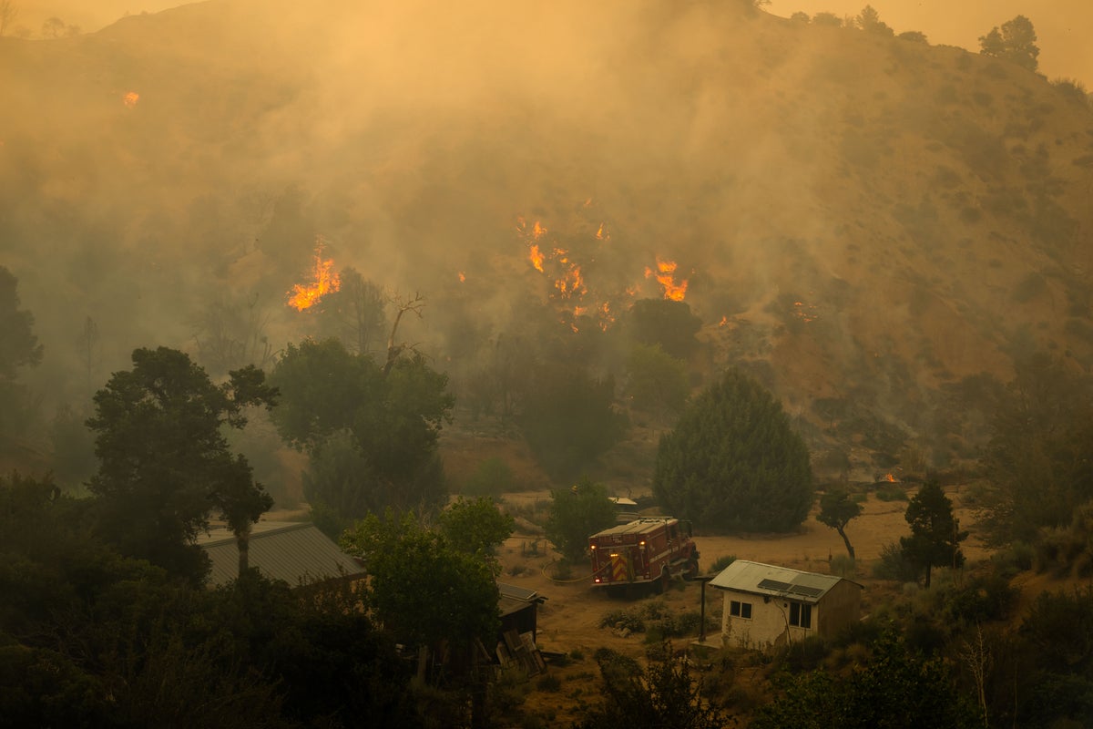
You think you know how fast a wildfire moves, but watching a small patch of desert brush turn into a roaring 2,677-acre monster in just a few hours changes your perspective. That's exactly what happened in the Antelope Valley when the Summit Fire erupted on Friday, July 10, 2026. It's a brutal reminder that Southern California's fire season isn't just starting—it's getting more unpredictable.
If you live anywhere near Llano, Piñon Hills, or Wrightwood, you need to know what's happening right now and how to protect your home. Firefighters are battling zero containment on a blaze fueled by a punishing triple-digit heatwave and fierce desert winds. Also making headlines in this space: Why A Us And Iran Diplomatic Deal Remains Out Of Reach.
Here's the ground truth about where the fire stands, who needs to leave, and why this particular blaze is hitting harder than people think.
The Sudden Explosion of the Summit Fire
The fire sparked around 12:49 p.m. on Friday near Jesus Canyon Road and East Avenue Z in Llano, a rural community northeast of Los Angeles. It started as an eight-acre vegetation fire. Within two and a half hours, it swallowed 1,600 acres. By Saturday morning, it had scorched 2,677 acres, straddling the line between Los Angeles and San Bernardino counties. More insights into this topic are covered by Reuters.
A massive heat dome is sitting over the region, driving temperatures above 100 degrees Fahrenheit. Combine that scorching heat with single-digit humidity and steep terrain, and you get a perfect recipe for explosive fire growth. Air crews and ground teams from the Los Angeles County Fire Department and the Angeles National Forest are working around the clock, but containment sits flat at 0%.
Evacuation Zones and Shelters You Need to Know
If you are in northern Los Angeles County or western San Bernardino County, stop waiting for things to get worse before you pack. The Los Angeles County Sheriff's Department warned that evacuation zones can change in minutes.
Current Evacuation Orders
Mandatory Level 3 (GO) orders are active for these specific areas:
- Zone LAC-E107
- Zone LAC-E127-C
Active Evacuation Warnings
Residents in these zones need to be ready to move immediately if the wind shifts:
- Los Angeles County: Zones LAC-E126-A, LAC-E127-A, LAC-E127-B, LAC-E128-A, and LAC-E1340.
- San Bernardino County: Zones PIN005, PIN006, and WWD03 (covering parts of Piñon Hills and Wrightwood).
Where to Take Your Family and Pets
Don't just drive away blindly. Official shelters are up and running:
- Human Shelter: Antelope Valley Family YMCA (43001 10th Street West, Lancaster). Small pets are allowed here.
- Small Animal Shelter: Los Angeles County Animal Care Center (38550 Sierra Highway, Palmdale).
- Large Livestock: If you have horses or cattle, San Bernardino County Fire established its base camp near Mountain High West in Wrightwood, but check with local sheriff channels before moving trailers through heavy fire traffic.
What Most People Get Wrong About High Desert Fires
A lot of people think a forest fire is the only kind of wildfire to fear. That's a dangerous mistake. The Summit Fire is tearing through high desert brush and grasslands. Desert fuels dry out faster than heavy timber, meaning a fire can sprint across flat ground at terrifying speeds when pushed by afternoon winds.
This fire is also doing long-term ecological damage that won't recover in our lifetime. The flames are actively tearing through centuries-old Western Joshua trees. These trees are legally protected under California law because they're ecologically valuable and native to this fragile ecosystem. Once they burn, they rarely come back, fundamentally changing the landscape.
Toxic Air and Health Risks Far Beyond the Flames
Even if the flames aren't directly outside your window, the air might be hurting you. The National Weather Service and the South Coast AQMD issued severe air quality alerts for high-elevation areas. This includes the San Gabriel and San Bernardino mountains, stretching all the way to Big Bear Lake and Lake Arrowhead.
People in Apple Valley and Victorville are already reporting a heavy stench of smoke in the air.
If you can smell smoke, you're breathing in fine particulate matter ($PM_{2.5}$). This stuff gets deep into your lungs and enters your bloodstream. Children, the elderly, and anyone with asthma or respiratory issues should stay indoors entirely. Run your air conditioning on "recirculate" mode and crank up your indoor air purifiers.
Your Immediate Next Steps
If you're anywhere near the fire perimeter, do these things right now:
- Map check: Fire lines move faster than news reports. Keep an eye on the official LA County emergency map at lacounty.gov/emergency or check sbcounty.maps for San Bernardino updates.
- Pack the essentials: Don't waste time grabbing electronics you can replace. Grab your hard drive, birth certificates, prescription medications, pet food, and enough clothes for three days.
- Prep your property: If you aren't under a mandatory order yet, clear your porch of cushions, close all windows, and leave your garden hoses hooked up for emergency crews.
The heat dome isn't going anywhere this weekend. This fire is going to be a long, tough fight for the hundreds of personnel on the ground. Be smart, pack early, and get out when the alerts tell you to.