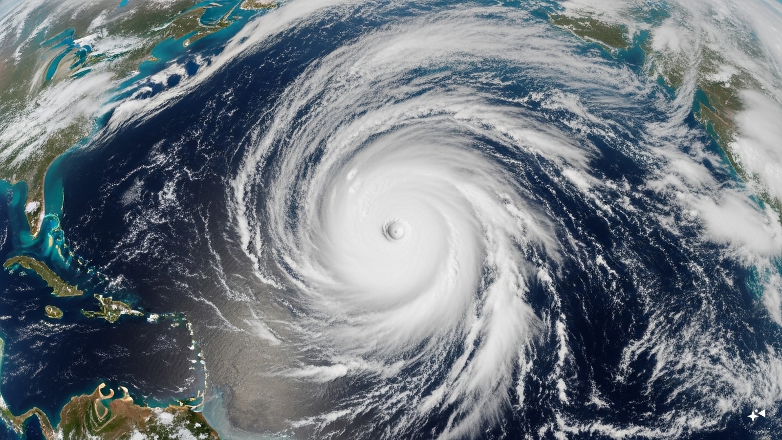
Weather maps are lighting up on both sides of Mexico, and the internet is doing what it always does. People see a couple of spinning storm graphics on social media and assume a coast-to-coast disaster is brewing. They panic about the wrong things while completely ignoring the real risks.
On Sunday afternoon, Tropical Storm Fausto officially organized in the Pacific. At the exact same time, a slow-moving tropical depression sat churning in the warm waters of the Gulf of Mexico. If you look at the standard news alerts, they treat these two systems like identical twins. They are not. One is a high-profile ocean powerhouse that will likely head out to sea without touching a single soul. The other is a lazy, unnamed blob that could quietly flood your living room.
Understanding the difference between wind speed hype and actual coastal vulnerability determines how you prepare. Let's break down exactly what is happening in the atmosphere right now and why standard news coverage misses the point.
The Real Story Behind Tropical Storm Fausto
Tropical Storm Fausto formed roughly 750 miles south-southwest of the southern tip of Baja California. According to the U.S. National Hurricane Center, it emerged from a disorganized tropical depression and quickly found its footing over warm waters. Right now, it packs maximum sustained winds of 40 mph and is tracking west-northwest at a steady 13 mph clip.
Forecasters expect steady or even rapid intensification over the next 24 hours. By Monday night, Fausto will likely become a full-fledged hurricane.
That sounds terrifying on paper. A hurricane forming right off the coast of Mexico always grabs the big headlines. Yet, no coastal watches or warnings are in place for Fausto. Why? Because the storm is marching away from land. It is moving into the open sandbox of the Pacific Ocean.
The atmosphere in the Eastern Pacific features a strong subtropical ridge that acts like a massive steering wall. This ridge is shoving Fausto out to sea. Unless that ridge breaks down unexpectedly, the storm will spend its peak intensity spinning over open water, eventually dying out when it hits cooler currents.
The same fate is currently swallowing Tropical Storm Elida, which is sitting further west. Elida has 60 mph winds but is rapidly weakening into a remnant low. The Pacific is busy, but it is mostly a spectator sport right now.
Why Open Ocean Hurricanes Still Matter
You might think an offshore storm is completely harmless. That is a dangerous assumption if you operate shipping vessels or manage maritime logistics. Open-ocean systems generate massive ocean swells that travel thousands of miles. These swells cause deadly rip currents along the western coast of Mexico and southern California.
- Swell generation: A storm with 80 mph winds can push 15-foot waves out for hundreds of miles.
- Rip current risks: Beachgoers who think the weather is perfectly sunny can get pulled out to sea by invisible currents triggered by a storm halfway across the ocean.
- Shipping disruption: Commercial routes between South America and US ports have to bend around these systems, spiking fuel costs and delaying supply chains.
The Sleeping Giant in the Gulf of Mexico
While everyone watches the Pacific hurricane-to-be, the real danger is sitting completely still south of Florida. A tropical depression is currently parked about 190 miles south-southeast of Panama City, Florida. It has weak sustained winds of just 30 mph. It does not even have a name yet.
It is far more dangerous to American communities than Fausto.
This system is essentially stationary. It is sitting over a pool of incredibly deep, warm water in the northern Gulf. Warm water is rocket fuel for tropical systems. The National Hurricane Center expects this depression to organize into a named tropical storm early in the week.
A tropical storm watch already blankets parts of the Florida Panhandle stretching to the Alabama border. Because this system is moving like a snail, its impacts will be prolonged and severe.
The Slow Moving Nightmare
Fast storms blow through, knock down a few tree branches, and leave. Slow storms cause catastrophe. When a tropical system stalls, it acts like an atmospheric conveyor belt, picking up endless moisture from the ocean and dumping it repeatedly over the exact same pieces of land.
The current track shows this system hugging the northern Gulf Coast for days. It will likely crawl westward toward Louisiana and Texas. If you live in low-lying coastal areas in northern Florida, Alabama, or Mississippi, you need to ignore the wind category and focus entirely on water.
The Deadly Misconception of Storm Categories
The biggest mistake people make during hurricane season is focusing on the Saffir-Simpson scale. We have been conditioned to think Category 1 means "minor" and Category 5 means "run away." The scale only measures peak wind speeds. It says absolutely nothing about rain or storm surge.
History proves that weak, unnamed depressions or minimal tropical storms cause massive damage through inland flooding. Think back to storms like Tropical Storm Allison or Tropical Storm Claudette. They were messy, poorly organized systems that moved slowly and dropped feet of rain, paralyzing major metropolitan areas.
The Gulf system is setup to do something similar. A stationary 30 mph depression can drop 10 to 15 inches of rain over a three-day period. Soils in the Gulf region are already saturated from summer afternoon thunderstorms. There is nowhere for that new water to go. Rivers will crest, storm drains will back up, and streets will turn into canals.
Evaluating Your Actual Risk Profile
Do not wait for a storm to get a name before you decide to act. You need to look at your specific geography.
- Elevation: Are you in a designated flood zone? If you do not know, go check your local government GIS maps immediately.
- Infrastructure: Does your street historically flood during heavy summer downpours? If it does, a tropical system will make it impassable.
- Trees: Do you have shallow-rooted pine trees hanging over your roof? Saturated soil makes it incredibly easy for weak 40 mph winds to tip massive trees right through your ceiling.
How to Handle Dual Ocean Activity Without Panic
Seeing multiple tropical systems active on both sides of the continent makes for great apocalyptic clickbait. It feels unprecedented. In reality, it is completely normal meteorological behavior for July.
When the atmospheric environment becomes favorable for tropical development—meaning low wind shear, high moisture content, and warm sea surface temperatures—it usually happens across an entire region at once. The Atlantic and Pacific basins operate on different cycles, but broad planetary waves can create windows where both oceans explode with activity simultaneously.
Panic leads to terrible decisions. People run to the grocery store and fight over the last case of water when they should be cleaning out their gutters. They buy expensive generators they do not know how to operate while forgetting to check if their flood insurance policy is actually active.
Smart Steps for Gulf Coast Residents Right Now
If you are currently sitting under that tropical storm watch in the Panhandle or watching the track creep toward Louisiana, stop tracking every single computer model update. The models will wiggle back and forth. Focus on your immediate environment.
Clear your drainage paths. Walk outside and pull dead leaves, pine straw, and trash out of the street drains near your house. If the water cannot get out of your neighborhood, it will end up in your garage.
Secure your outdoor items. Even a weak tropical storm brings gusts that turn patio chairs into missiles. Toss them in the pool or bring them inside.
Prepare for localized power outages. Slow-moving systems soften the earth, causing utility poles to lean and tree limbs to snap. You do not need a two-month supply of survival rations, but you do need enough flashlights, fresh batteries, and non-perishable food to comfortably survive a 48-hour grid failure.
The Moving Target of Tropical Forecasting
Meteorology is a science of probabilities. The National Hurricane Center is highly accurate, but a system that is currently stationary is incredibly tough to predict long-term. Small changes in upper-level steering winds can completely alter where the center of the storm eventually tracks.
If a weak high-pressure system builds over the central United States, it could push this Gulf depression further south into open water. If that ridge weakens, the storm could pull north into Mississippi or Alabama much faster than anticipated.
Keep your eyes on the official updates from your local National Weather Service office. They know the local terrain, the specific river basins that are prone to overflowing, and the exact coastal bridges that will flood first. Stop relying on national cable news loops that show reporters standing in the surf. Get the local data, make a practical plan, and secure your property before the outer rainbands start showing up on radar.